
Довідка:Візуальний редактор/Мапи
Main help pages:
- current: How to create maps with Kartographer in VisualEditor
- Introduction to Kartographer in wikitext
- Kartographer - extensive help page
Додавання мап за допомогою візуального редактора
Inserting a map

Щоб додати нову мапу на сторінку, виберіть «Вставити» у меню інструмента «Візуальний редактор». Потім натисніть посилання «Більше», щоб побачити параметр «Мапа». Виберіть «Мапа». Мапа буде додана там, де знаходиться курсор. Click "More" to show the entire menu, then select "Map". This will add a map at the current location of your cursor on the page.

Setting map center point, size and proportions
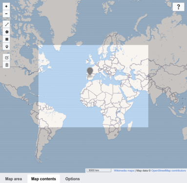
The dialog window displays an interactive map with three tabs below it: "Map area" (selected by default), "Map contents" and "Options". Натискання значка «Мапа» відкриває діалогове вікно, яке відображає інтерактивну мапу. Щоб встановити місце розташування, перетягніть інтерактивну мапу та використовуйте кнопки «+» та «-», щоб збільшити масштаб, доки не побачите те, що шукаєте. You can also manually enter latitude, longitude, zoom level and size in the fields below the map.
Adding markers and shapes
To add shapes and markers to the map, click the "Map contents" tab to display a toolbar. You can add lines, rectangles, polygons and markers.
After adding an element, use the pencil-and-paper icon ![]() in the map toolbar to modify it.
Note that adding elements to the map automatically expresses each element as GeoJSON in the text field at the bottom of the window.
You can also paste valid GeoJSON into the text field.
To remove an element, select the trash can icon followed by the element you wish to delete.
Then click "Save". You can also delete the element from the GeoJSON field below.
in the map toolbar to modify it.
Note that adding elements to the map automatically expresses each element as GeoJSON in the text field at the bottom of the window.
You can also paste valid GeoJSON into the text field.
To remove an element, select the trash can icon followed by the element you wish to delete.
Then click "Save". You can also delete the element from the GeoJSON field below.
-
 Map contents tab
 -
 Adding a marker
 -
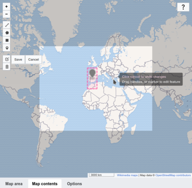 Editing a marker


Formatting options
Ви можете визначити розмір мапи, вирівнювання та потрібну мову для міток мапи. Зауважте, що не всі мітки доступні всіма мовами (Докладніше про мови мапи). You can define whether to show the map with or without a frame and how to align the map on the page. You can also select a language for map labels. Note: Not all labels are available in every language. (More information on map languages.)
Saving a map
Коли ви закінчите, натисніть «Вставити», щоб закрити діалогове вікно та вставити свою мапу на сторінку.

Editing an existing map
To edit an existing map's properties, select the map and then click the "Edit" button that appears.
To resize an existing map, select the map in the VisualEditor and then move the resizing arrows that appear on the bottom corner of the map. Note that this only changes the size of the map's frame on the page, not the zoom level nor any other of the map's properties.
To change a map's position on the page, select the map and then drag the map to its new location.
Вилучення мап за допомогою візуального редактора
Щоб вилучити мапу, виберіть її та скористайтеся клавішею Delete на клавіатурі. Ви також можете скористатися командою «Вирізати» з меню «Редагувати» вашого браузера.
Розширення налаштування мапи
Для розширених налаштувань мапи, наприклад для маркерів, користувацьких фігур або інших налаштувань GeoJSON, див. Help:Extension:Kartographer.